As boaters, and even before as frequent Orcas Island visitors, we have been in and around the city of Anacortes countless times. Best known (to us at least) as the ferry launch-off point to the San Juan Islands, it was much less known (to us at least) as a superb spot to view those same San Juan’s from above. Right smack dab in the middle of this cool little town are 2800 acres that contain 2 mountains surrounded by beautiful forests full of lakes, meadows, wetlands, 50 miles of multi-use trails, and serenity. This oasis, the Anacortes Community Forest Lands, was originally acquired by the city of Anacortes as part of the purchase of The Washington Power, Light and Water Company in 1919. The city logged the land for about 65 years until it was no longer productive, and it was converted to protected recreational land in the early 1990’s. It is now nicely monitored and maintained by the Skagit Land Trust.
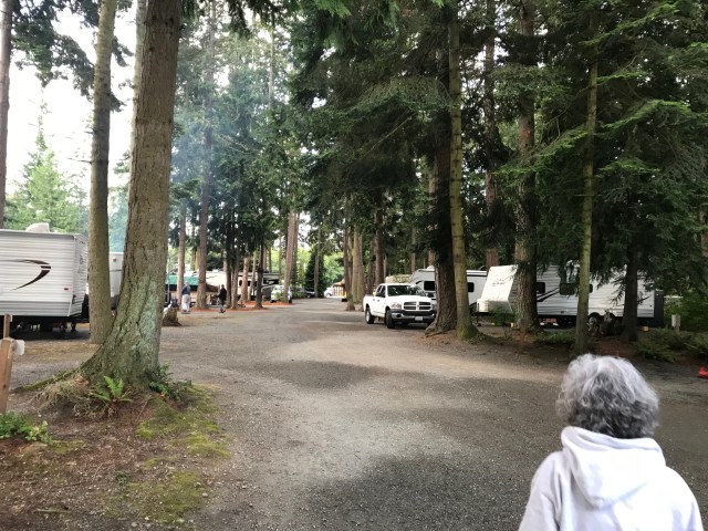
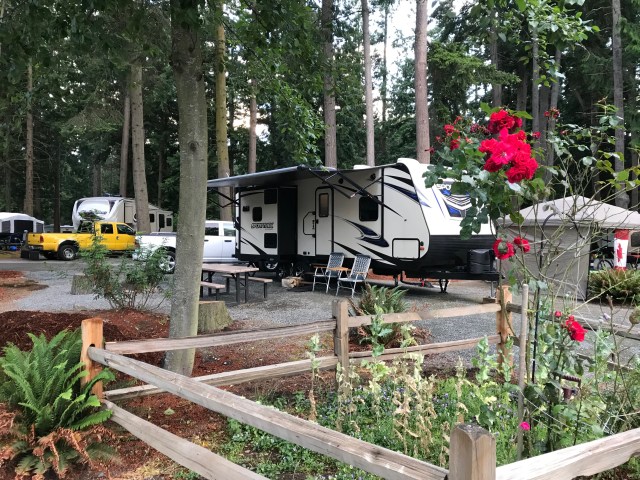
This gem caught our attention way past the time that we would be able to grab a State Park camping site reservation, so we opted to stay at the privately held Pioneer Trails RV Park, just south of Anacortes. What a great park! We found it clean, spacious, and stuffed to the gills with Canadians, most of whom have a very long weekend because of their Independence Day, celebrated this year on Monday July 2. Our site had a beautiful garden in it.
We wondered why we see so many of our neighbors from the north in our local campgrounds, especially since the US Dollar to Canadian exchange rate isn’t very favorable to them. Their answer: there really aren’t any campgrounds around Vancouver, which has grown right up to the Cascades, forcing most campers to cross the mountains to find decent camping. So they head south! Faster and easier, and with the shorter commute and price of Canadian camping, cheaper. Plus, they get to make a Canadian tax-free Costco run on the way home.
Pioneer Trails sports many amenities, and we highly recommend it for families. There is a small Nature Trail, just right for wee ones, a Playground, horseshoes, basketball, nice clean bath houses, and what’s camping without a cheery fire in the evening?


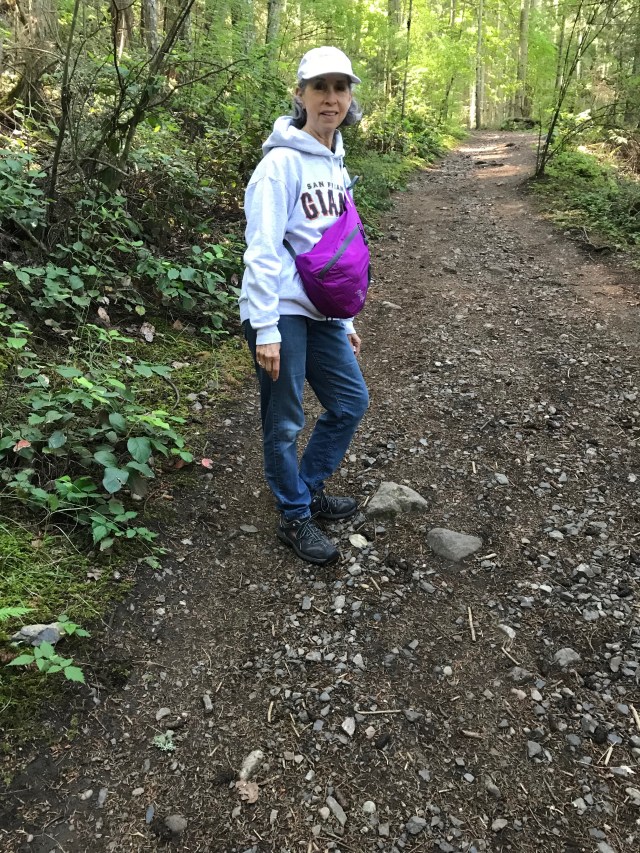
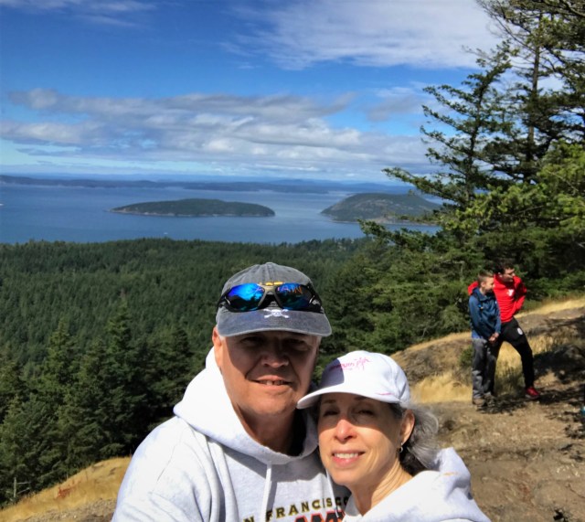
We came specifically to hike up Sugarloaf Mountain. Although Mt. Erie, its neighbor, is higher by over 200’, all the trail blogs I read said the view from atop Sugarloaf was far better. While Erie’s summit is drivable, Sugarloaf requires hiking a little over a mile up a pretty steep incline, rising a little over 500 ft. in that distance. Think walking a mile up a staircase and you get the picture. In the picture below, a horizontal line from my viewfinder would hit Wendy right in the waist. It’s hard to appreciate from the photo.
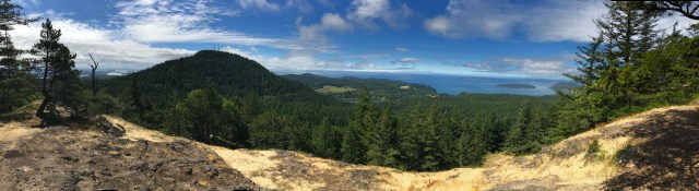
We think the view is worth the trip. We did make the drive to the top of Erie, but all the view areas were looking through trees at the landscape. And it was crowded, and parking lots, and cars, and motorcycles. Sugarloaf is more work, but with a bigger reward.
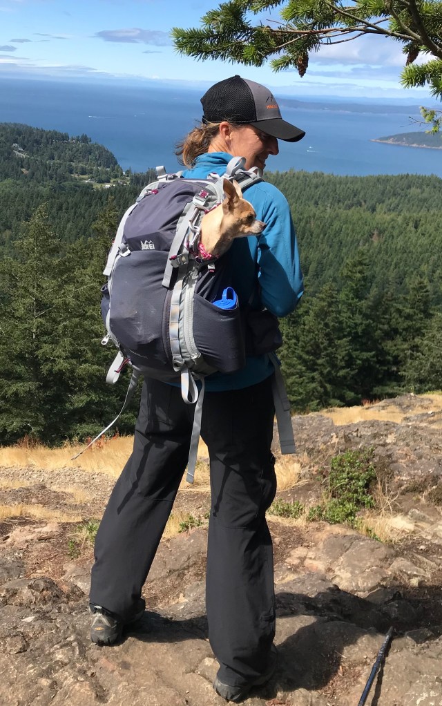
We saw one hiker with a wee passenger being treated to a piggyback.
One advantage to a hike in a forest which just happens to also be in downtown, ice cream for lunch! And it was even our favorite, Lopez Island! And, to boot, the rare Strawberry flavor! All in all, a pretty good trip! I couldn’t resist parking next to another Dodge pickup that was easily 60 years senior to mine.


Tippy, of course, has his own opinion.