Asheville North Carolina became a waystation for a 2-night rest-up because there are 2 things there we were interested to see, the Biltmore Estate and The Asheville Urban Trail. Both are rich in history. We know for a fact that one actually exists; we cannot say for sure the other is anything more than urban myth.
We stayed 2 nights at Wilson’s Riverfront RV, a very small RV camp that fronts the French Broad River. It wasn’t apparent that the woman this river is named after was either French or a broad, and besides I thought it impolite to hang that old-school description on her. Full disclosure: I may be somewhat misinformed about the origin of the namesake of this particular body of water.
The campground was very nice except for 2 anomalies: it is located midway between 2 interstates, thus a fair amount of road noise seeps in; although it is easy to drive FROM, it isn’t easy to drive TO when transiting back and forth to the city itself. This is due to the fact that the entrance to the campground is at the foot of an offramp, and if you can’t stomach the high-speed Evel Knevel U-turn at the bottom of the ramp into the driveway, you have to drive past and make the U-turn farther down the road. In any event, our GPS navigation on our phones was very happy to find a short way out of the park and into the city, but not so smart about finding a short way back. It always routed us back to the Interstate to make another aircraft carrier landing back into the driveway, even though there is a much tamer way to do it.
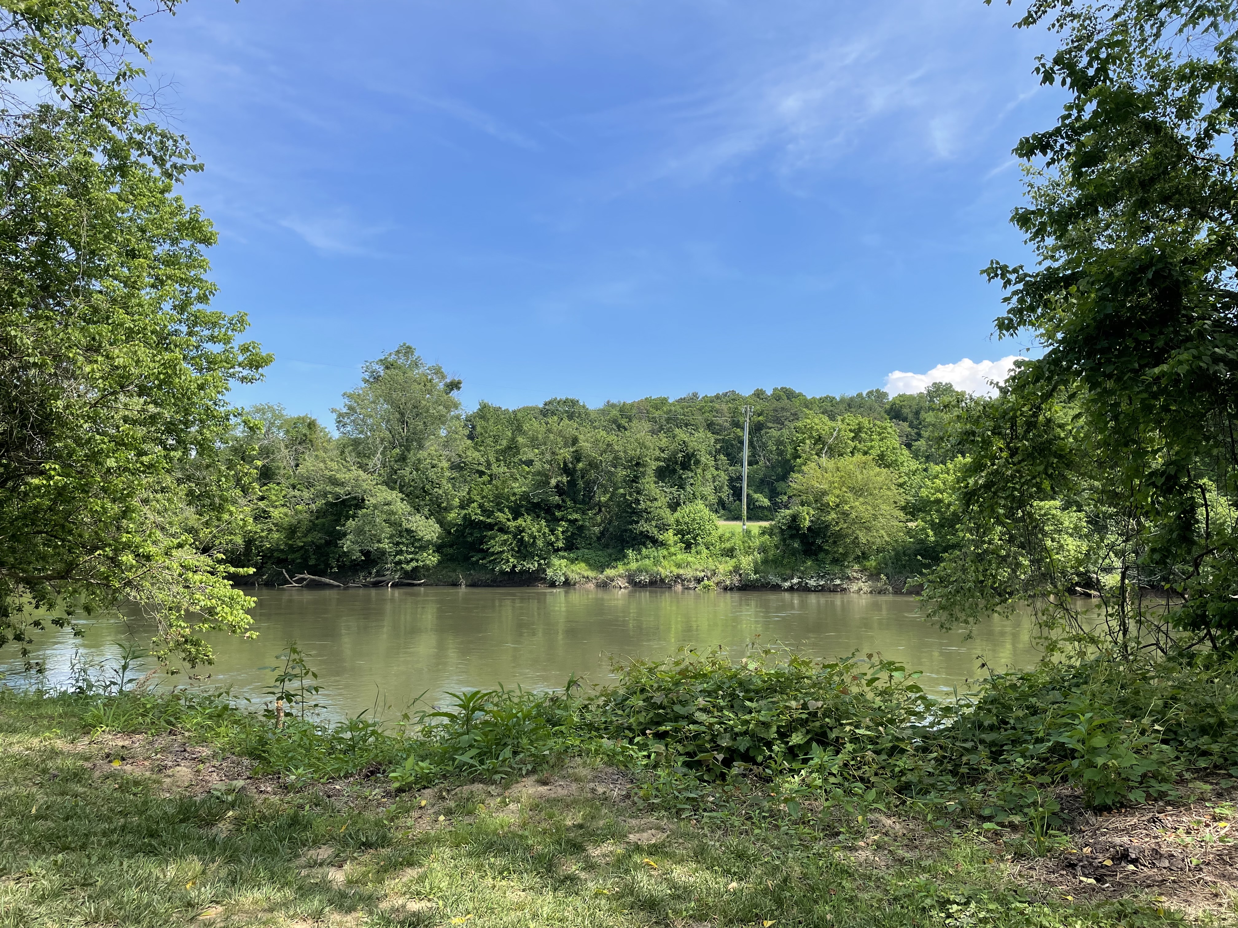
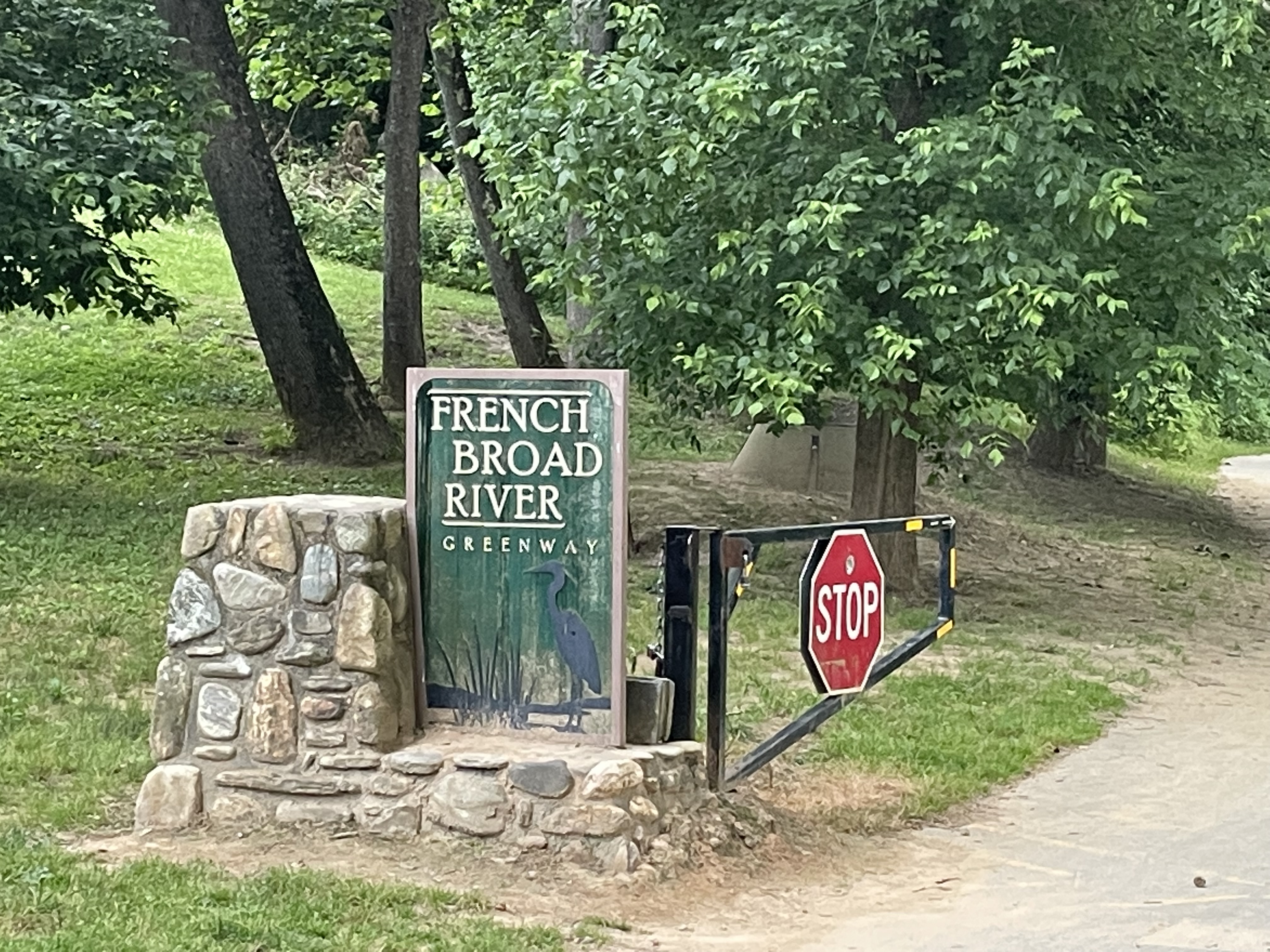
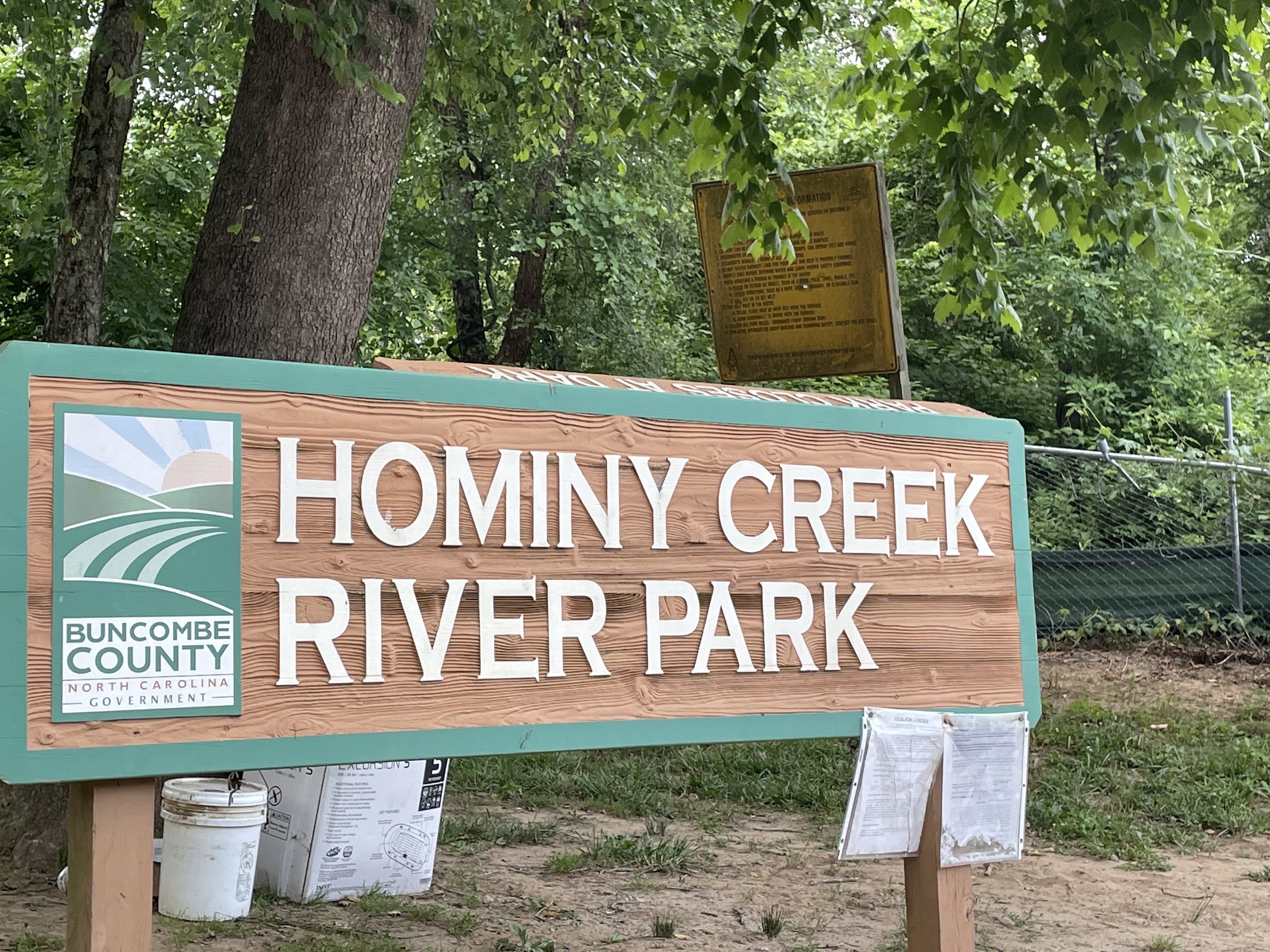
There is one more nice thing about the campground, it’s adjacent to the French Broad River Greenbelt walk, in fact the walk goes right through the center of the campground, right down the middle of the drive. It’s a very lovely 1 mile each-way walk to Hominy Creek Park and back. Spoiler alert: we added a piece of it to our MuddUrban Trail (details to follow).
First up was the Biltmore Estate. Because the directions to the entrance aren’t all that clear, and our tickets for the estate tour had a specific arrival time of 9:30AM, we went early to make sure we didn’t miss a window of opportunity. This worked out very well for us! The advertised opening time for the entrance gate to the 8000-acre estate is 9AM, and the website advised us to arrive early to make sure we would have time to drive several miles inside the estate to the house tour location, park, and then walk another distance to the actual tour start. We left the trailer at 8AM, arrived at the entrance gate at 8:13AM, and they had just swung it open early for some reason.
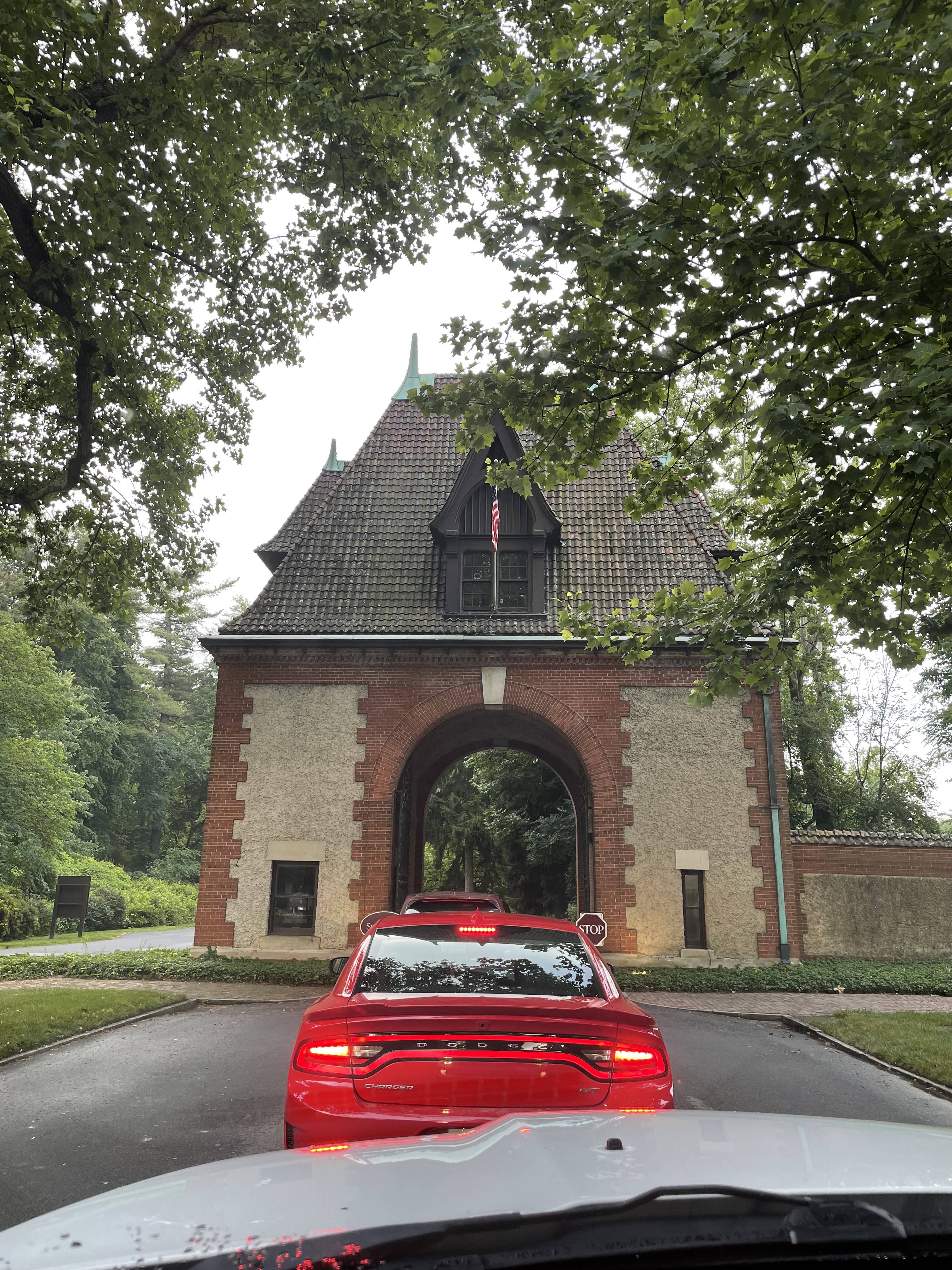
They scanned our tickets and let us in, and we arrived at the parking a few minutes later. We walked from the parking to the tour entrance security shack (where we got scanned for the first of 3 times) in another couple of minutes and found ourselves on the estate property before anyone else except employees. Just like Carlsbad Caverns, we had the place to ourselves.
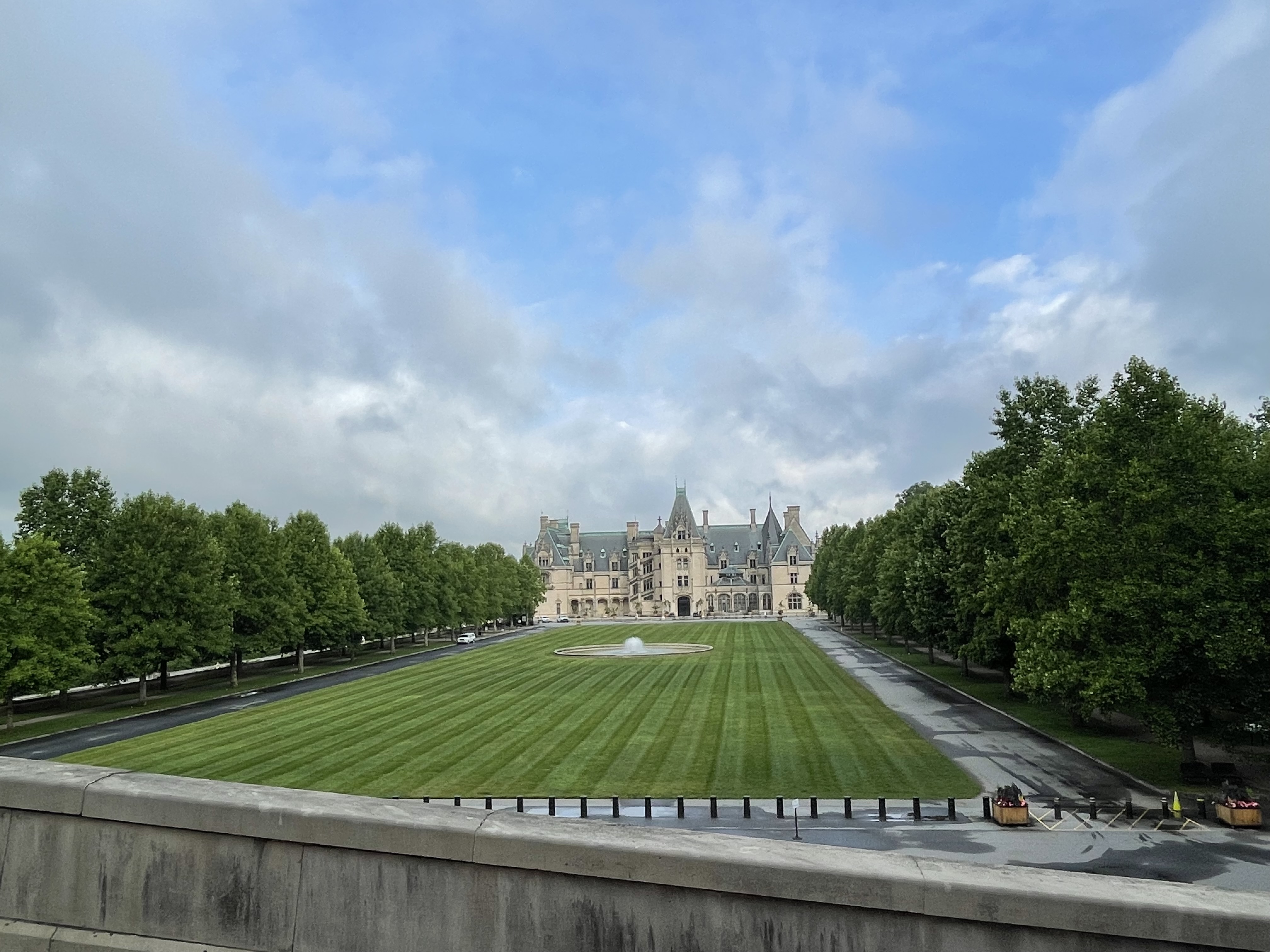
So, we cooled our jets walking the very extensive gardens (there are 5, and they are very large) until we could queue up at the door to the massive house for our 9:30 AM start time. By then, a couple of hundred other guests had joined, but we still felt special.
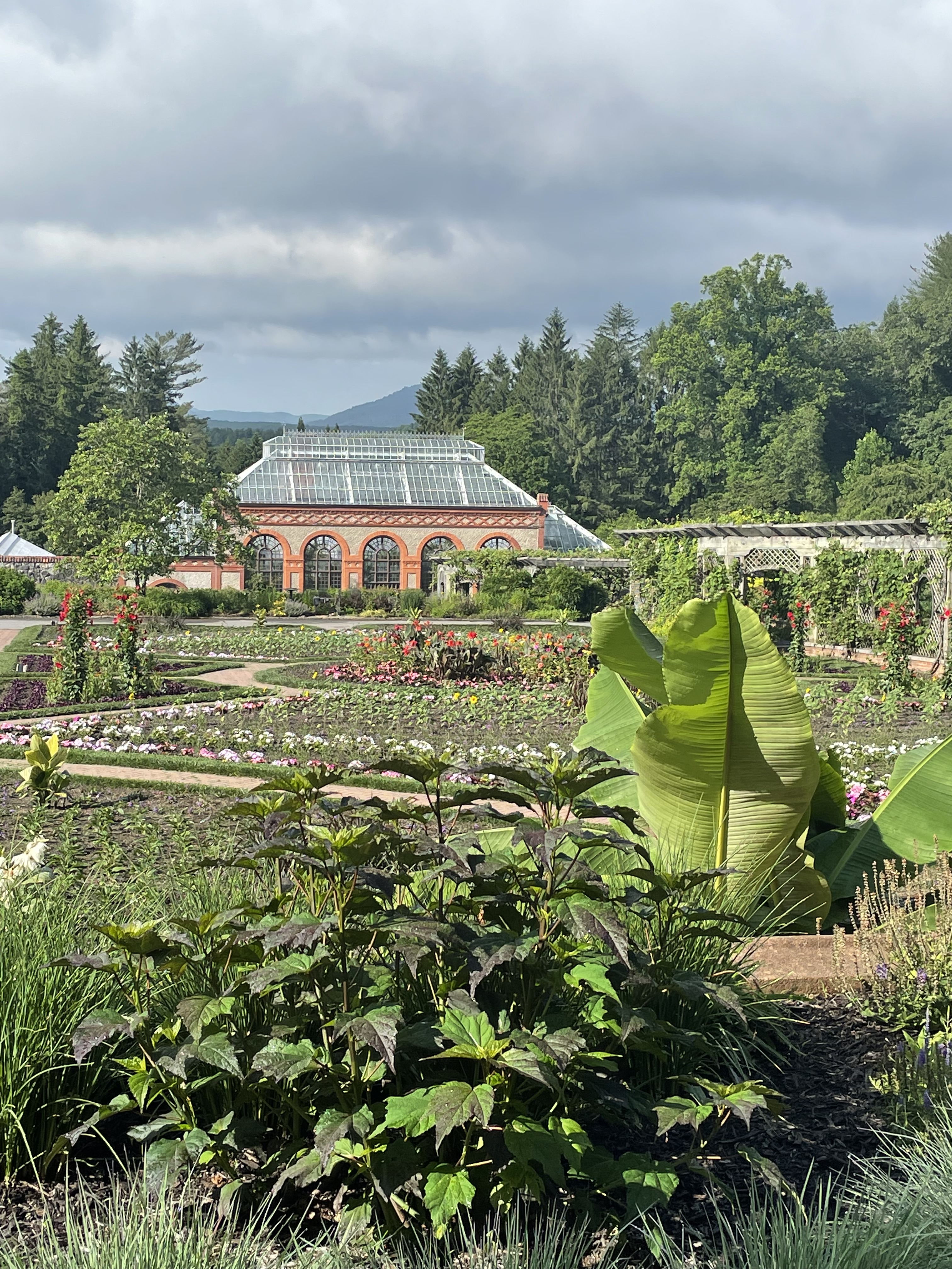
The house tour was impressive, and we highly advise that if you ever do this make sure to get the Audio Tour option. It would be wasted without the little device you hold to your ear to get the lowdown at each numbered feature. The tour itself is pricey, $94 each (audio tour included), but it’s the only time in our life we will do it, for sure. We did notice several couples that must have an annual pass who park in a different lot and just walk the dozens of miles of paths on the estate without going on the house tour. It’s such a beautiful place to walk.
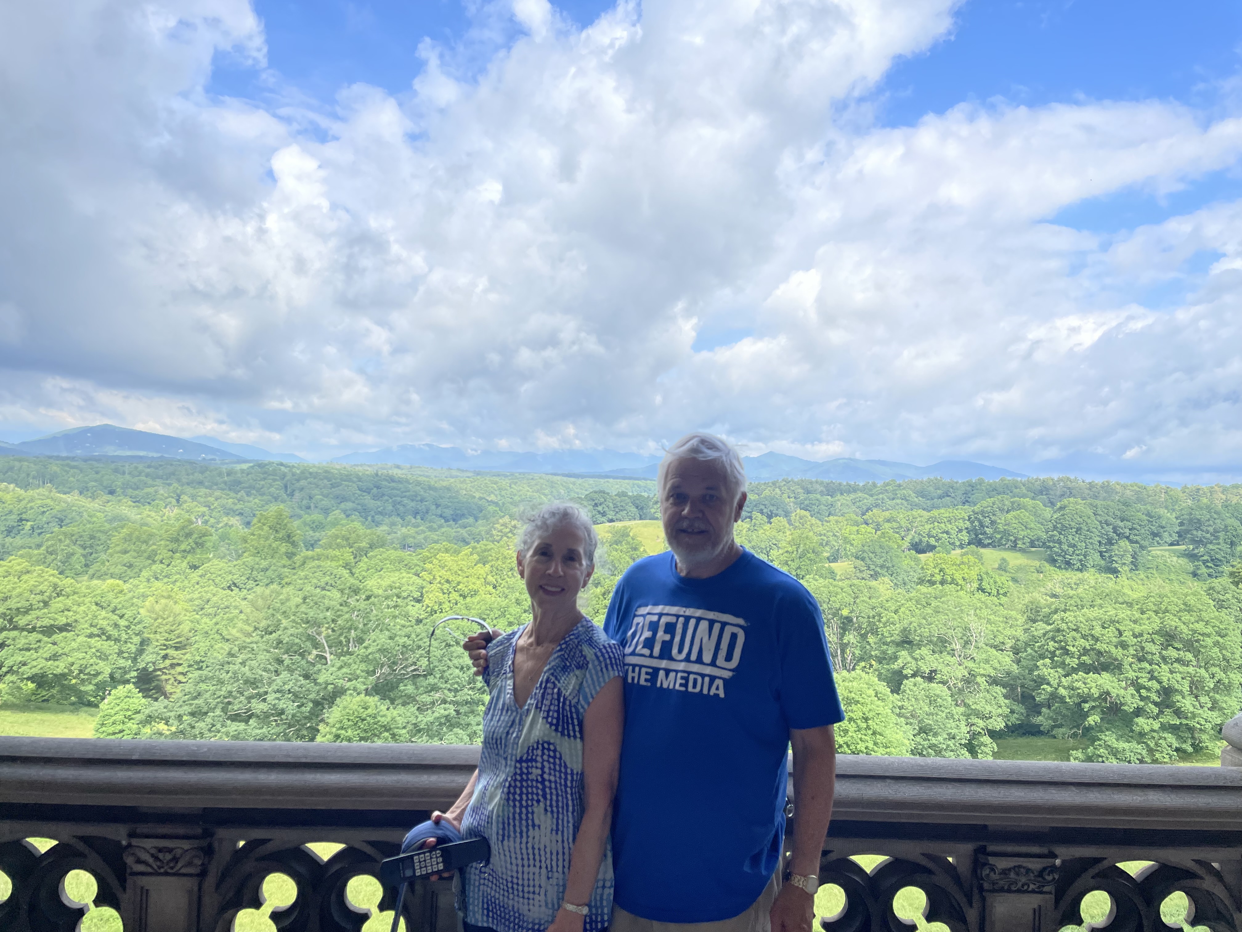
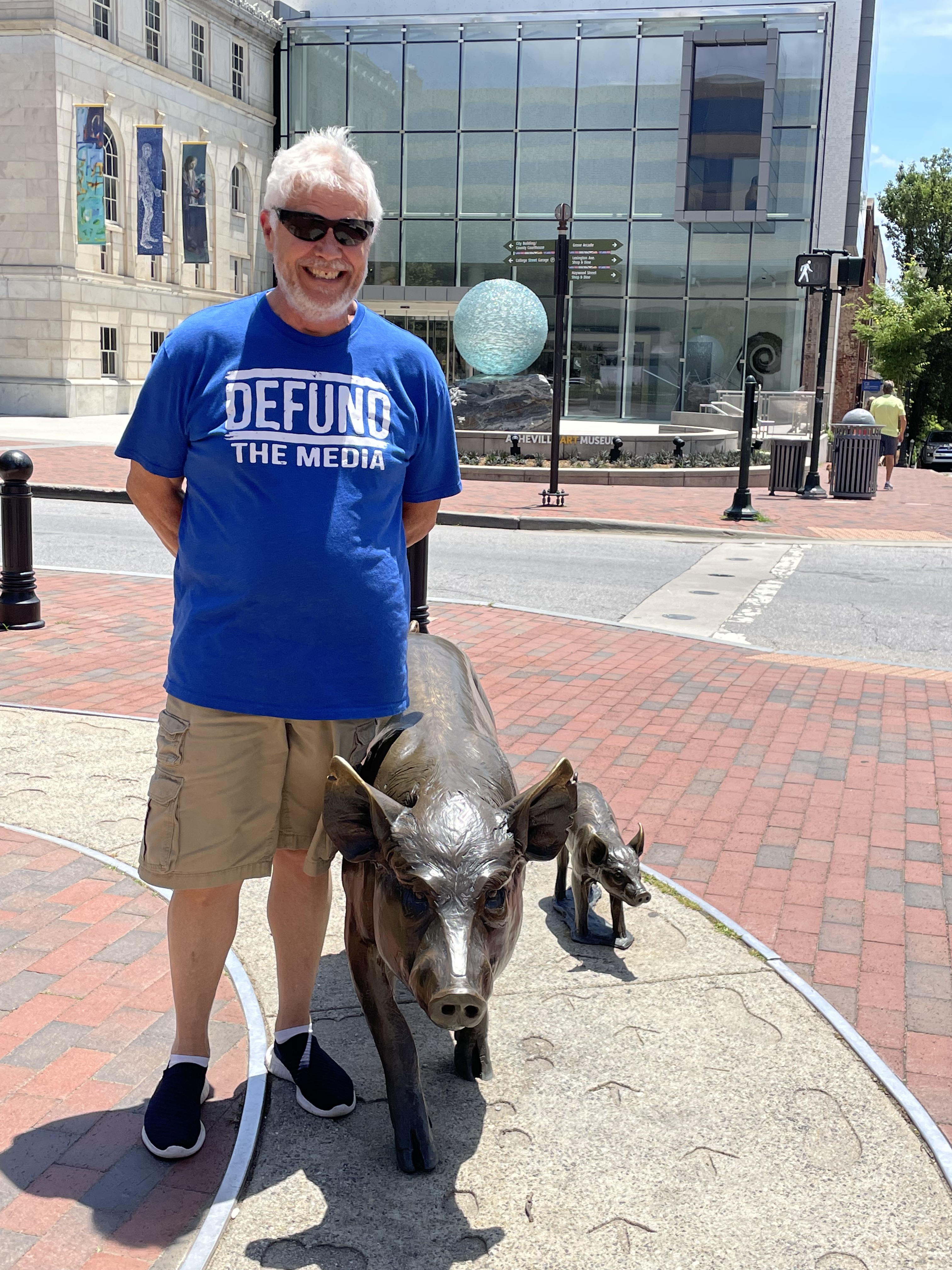
One thing stood out during our time at the estate. I opted to wear one of my political statement t-shirts (mostly because it was on top of the stack) which reads “DEFUND THE MEDIA”, and this caught a lot of eyes. We almost couldn’t walk 50 yards without somebody commenting on it, in a positive way. This same shirt got a total of 3 such responses in the 3 prior weeks, and all of a sudden, every tourist in Asheville thinks it poignant. It certainly is a conversation starter.
After the roughly 2-hour tour, we popped over to the Stable House and enjoyed an ice cream, then took a long leisurely drive around the estate back to the exit and onto the Interstate for another carrier landing shot at the RV Park. We rested for an hour or so and headed for the city proper to check out the Urban Trail and some lunch.
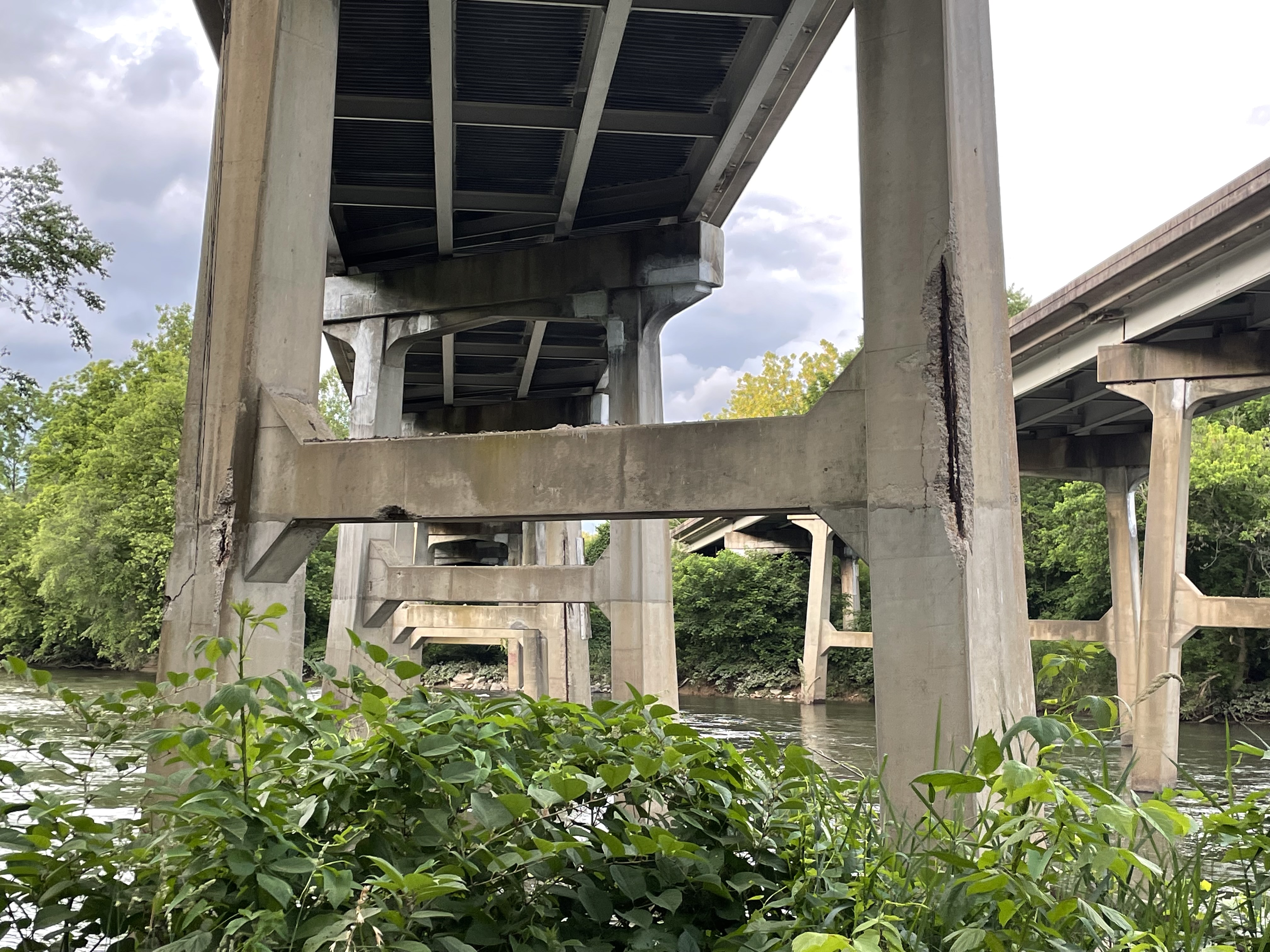
Our GPS and the Asheville website took us exactly to the “First Stop” of the Asheville Urban Trail, which featured a brass plaque affixed in brickwork. Except it doesn’t exist, at least as far as we could see. We found, at that exact spot, a small square (Pack Square) where there apparently used to be a Civil War statue that was found to be objectionable by the city council 2 years ago. The monument celebrated a war general (not sure whether he was Union or Confederate) that apparently was a slave owner, so they tore it down and removed the commemoration plaque. We think this also did the First Stop of the Urban Trail in, and it was key because it also gave you instructions on how to find the Second Stop, and so on down the line. Without that key guidance we couldn’t navigate to the next stop, so we decided to strike out on our own (pioneers we are!) and started the MuddUrban Trail. And we didn’t confine our scope to the city core either. Our First Stop was way back on the French Broad River Greenbelt path, midway between Wilson’s Riverfront RV and Hominy Creek River Park. There’s no guarantee that this feature will be here for any substantial period of time, but when it finally comes down everyone in the United States will be made aware of it, because it’s part of the support structure for Interstate 40 directly above it.
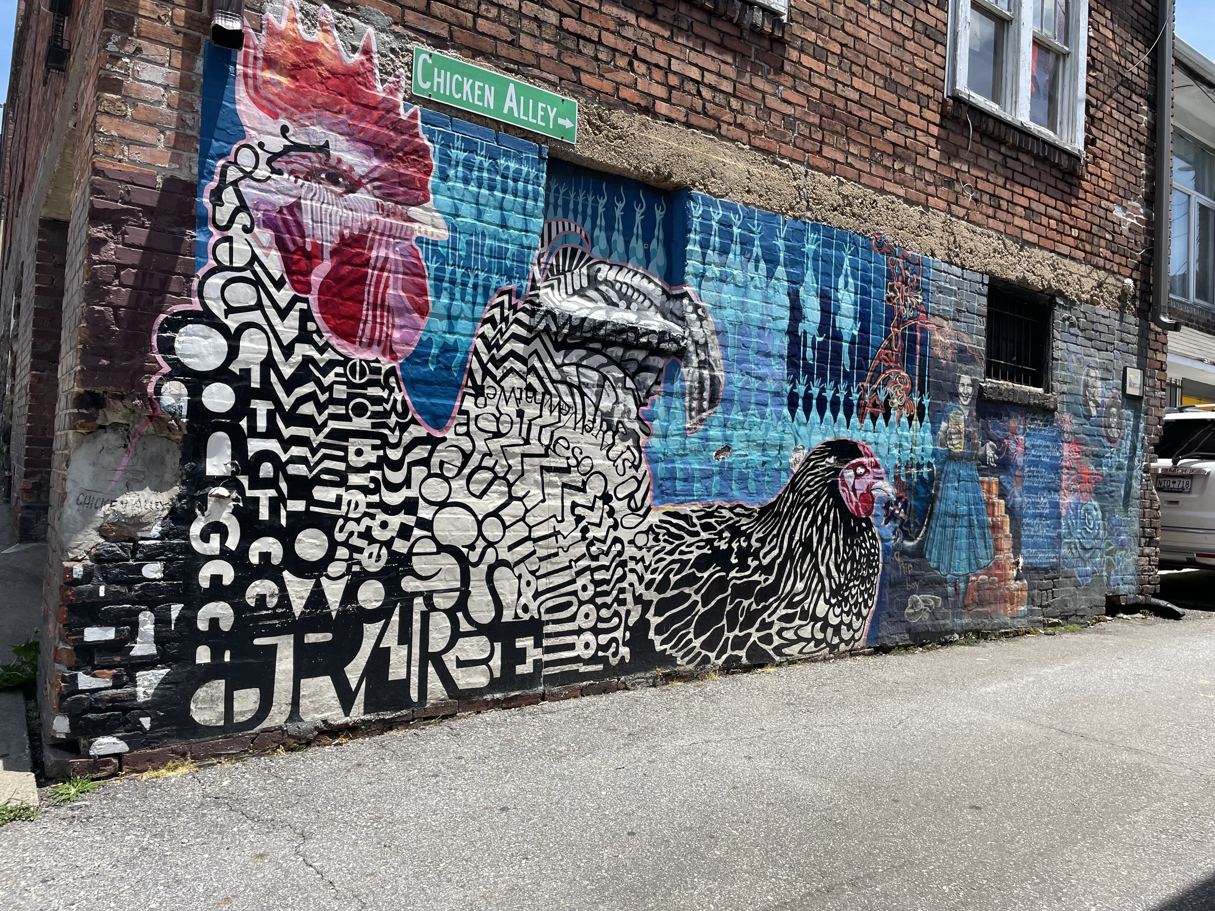
Next stop on the MuddUrban Trail is Chicken Alley. We have no idea how this name got applied (note the plethora of dead chickens hanging), but the mural earned it a spot on our roster.
In fairness, each of our highlight spots won’t provide any navigation to the next, you will literally need to have a printout of this blog to have even a slim chance of traveling this trail.
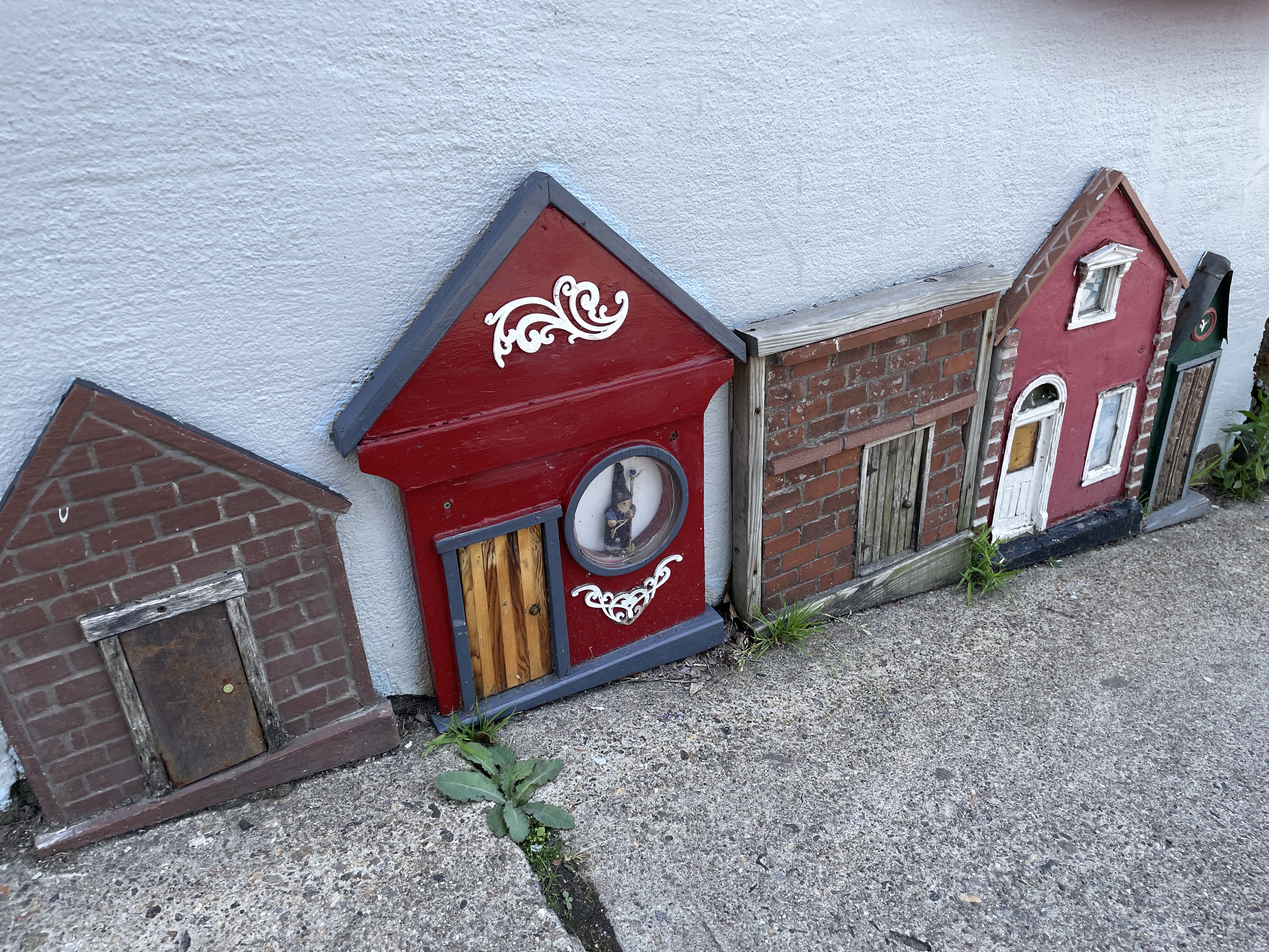
Our next feature is Gnome Row. Along one of the streets leading away from Chicken Alley, some witty local has fashioned a bunch of small facades on bare spots of the building wall, giving the impression of a block of gnomish brownstones.

In a nod to the richness of agricultural history, our next stop features a couple of pigs. Editor’s note: the pig wearing the t-shirt isn’t actually a part of the local agricultural history.
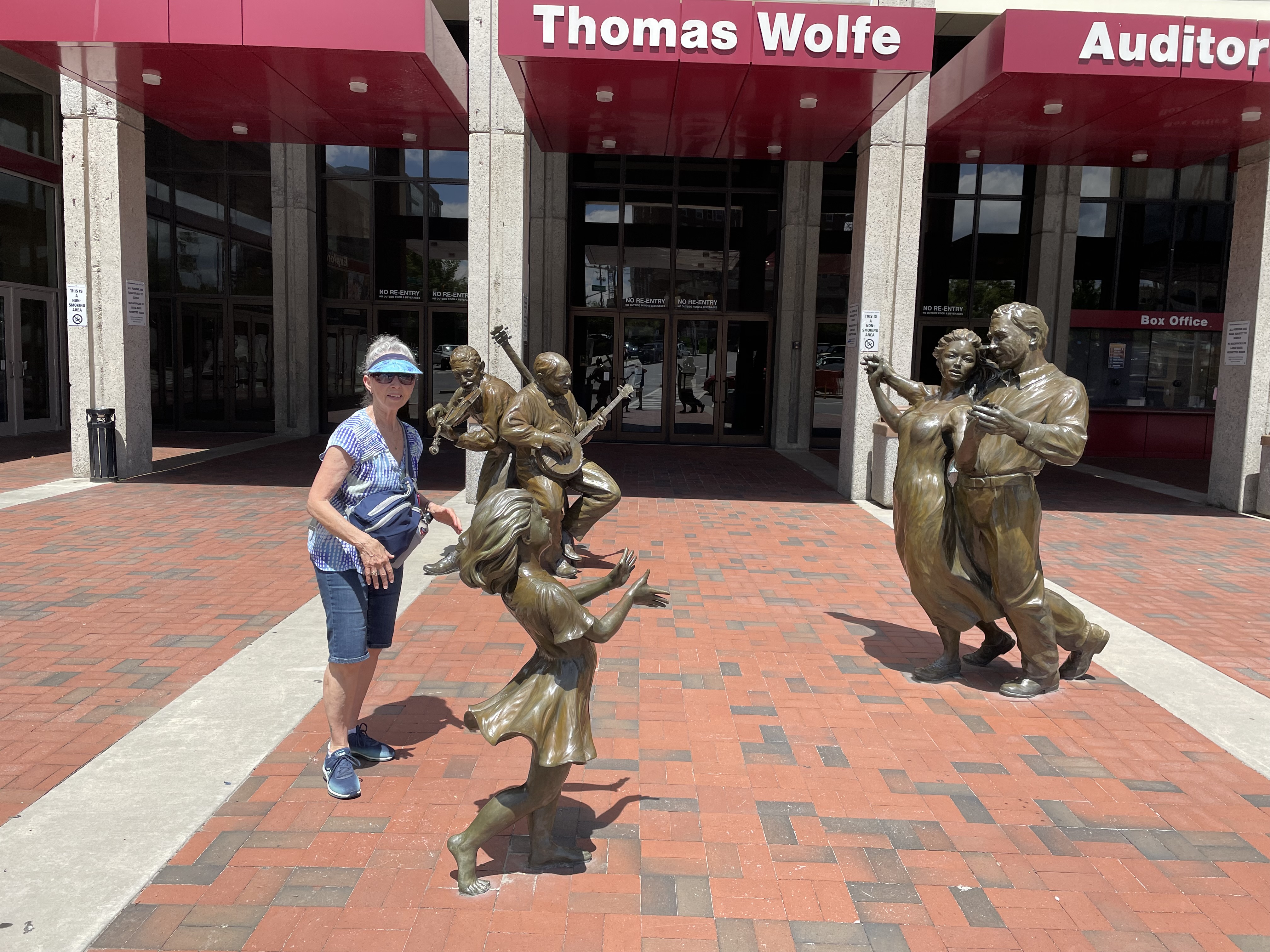
Showcasing entertainment, Wendy introduces us to our next stop, the Dancing Brass.
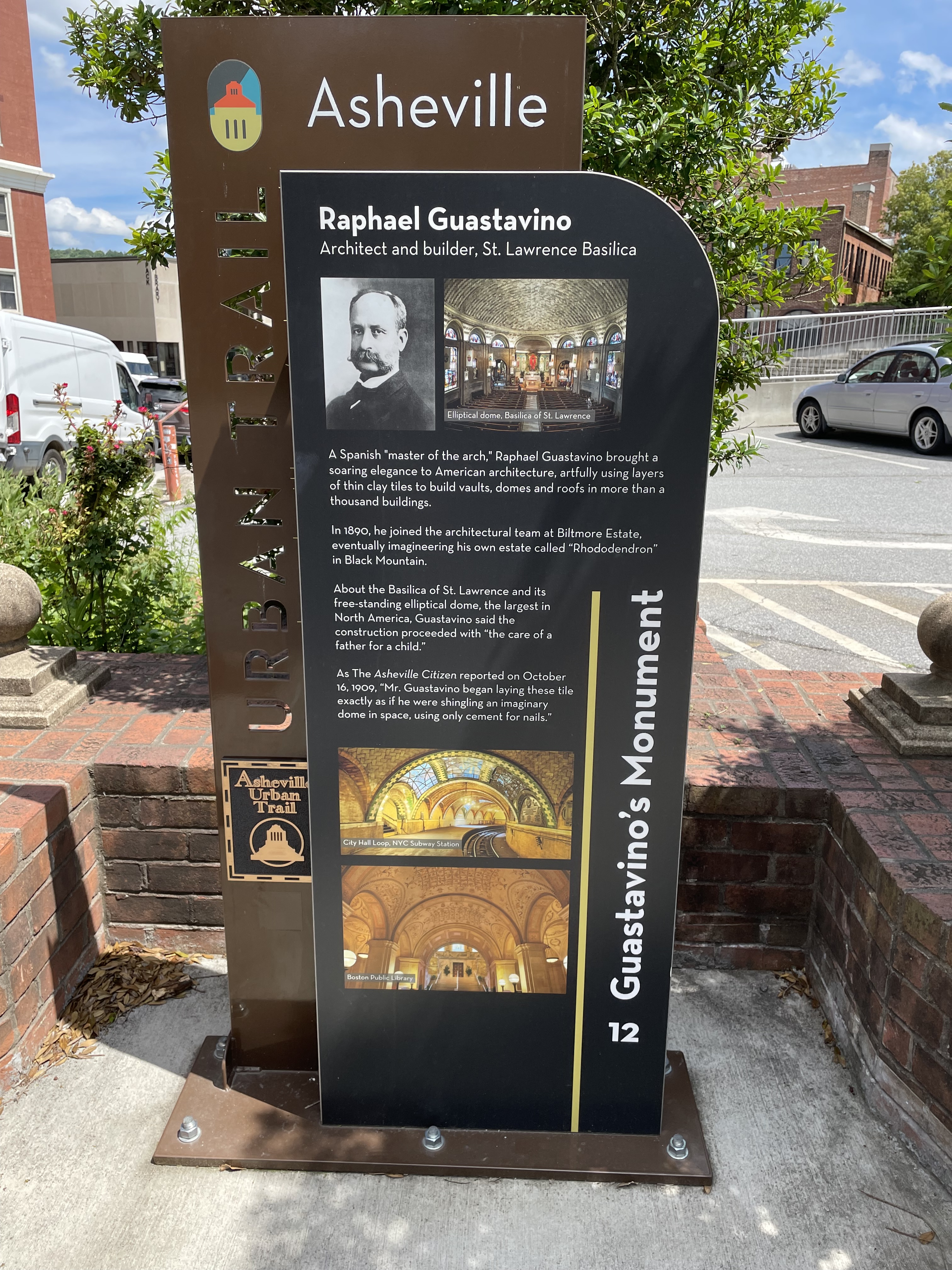
In a plug for the religious cultural past (and very likely present) of Asheville, our next stop is the St. Lawrence Basilica, a Catholic construction from the late 1800’s that was not only beautiful inside, but cool as well with some impressive air conditioning.


Sharing the only actual Urban Trail marker we saw is our next stop, a plaque commemorating the architect of the St. Lawrence Basilica, Rafael Guastavino.
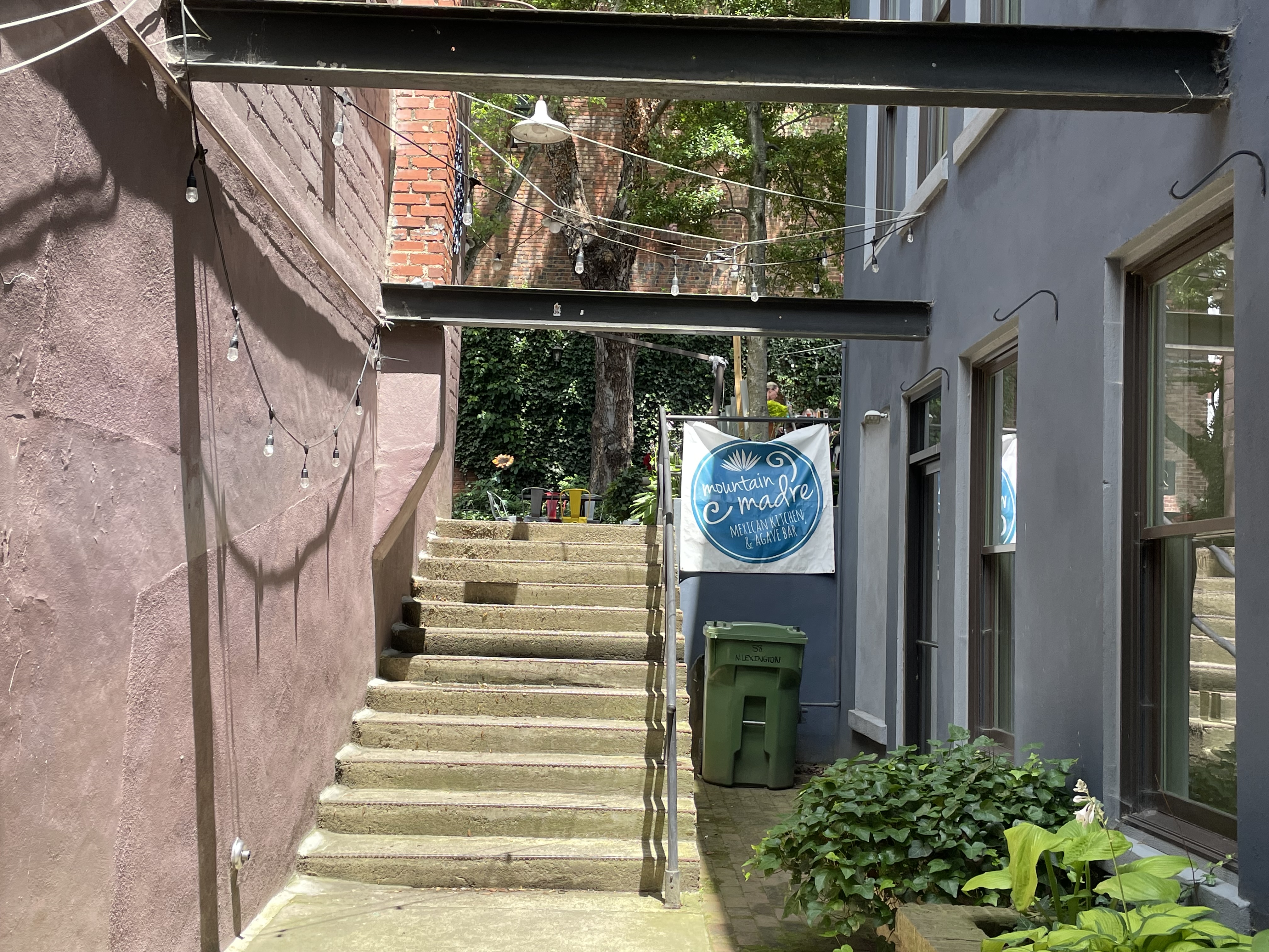
By now having worked up one heck of an appetite (11,000 steps for the day and counting), we add our last stop on the MuddUrban Trail, Mountain Madre, found almost by chance in a back alley, and serving fabulous Central American cuisine where we dined ala patio.
While we couldn’t easily find it, I’m sure the Urban Trail exists. After all, we did find a marker, even if purely by accident. But you don’t need a formal trail to have fun exploring any city. You need good walking shoes, and an adventurous spirit. And water. Plenty of water.
Tippy is a big believer in remembering the past so you don’t repeat the mistakes.