
Patience is a virtue, so they say. And I now know who are the all-time Patience Supremes. Hippies. I mean, here we are almost 60 years after the Age of Aquarius, and what do we have? When pot is legal and haircuts aren’t, the Hippies have won. I have nothing against hippies, just like I never had anything against J. Edgar Hoover. But I don’t cross-dress, and I don’t like my hair long. So there.


Okay, now that I have that out of my system, on to better things. It looks like we were way ahead of the curve when we got our newest travel trailer. There is a huge rush on the market for RV’s and boats right now. Folks that might have once jumped on a plane to take their family somewhere nice for a vacation are now thinking better of it. They are buying up motorhomes, travel trailers, pop-up campers, and boats like there is no tomorrow. Many places are so low on inventory they simply can’t stay open until the factories catch up. They are now calling RV’s “Covid Campers”.
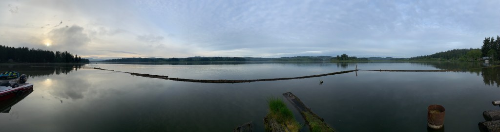
We lugged our Covid Camper up to Mt. St. Helens for the Memorial Day weekend. We have talked for years about going there, and I guess we finally got the talking part completely done. Of course, all the State Campgrounds were closed, as were all the State and National park offices and Visitor Centers, but we found a nice private RV park right on the shores of Silver Lake with the volcano in sight farther up the Toutle River Valley. Silver Lake RV Resort has a little marina, and a small hotel that hangs out over the lake. They advertise that you can fish “right off your balcony”, and we saw people doing just that.
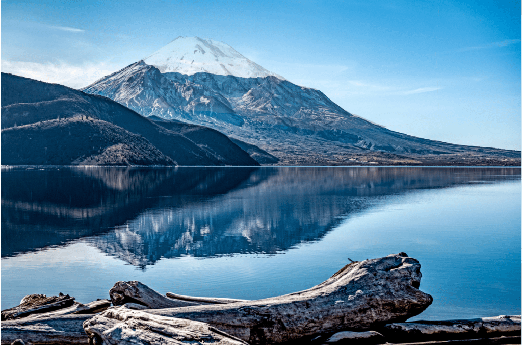
We arrived Saturday afternoon, and there was rain forecast for the weekend, but Sunday would have none of that. A bright and early breakfast, and we headed out toward the north side of the large blast zone, intent on making our way up to the Johnson Observatory. We were very keen to get a first-hand look at the destruction done on May 18, 1980, when the mountain finally blew after several small eruptions, and lots of shaking. Jean Sherrard, a photographer and journalist, photographed the mountain in 1979 from the far side of Spirit Lake, and had recently trekked back to almost the same spot to take an “after” picture of the mountain. I superimposed his “before” (the ghosted image) onto his latest picture to give you an idea of how much of this mountain went kablooey. It lost 1300 feet off the top, gone in the large explosion and blown into smaller sized debris. But much more material was lost in the 3 near simultaneous landslides that took most of the northern face. They call each slide a “Block”: Block 1 was the topsoil and surface “crust”, and it broke free when the explosion happened, then slid down the mountain at 180 mph, and twisting sideways on its path. Block 2 was the underlying rock shell of the mountain, and it broke loose 2 seconds later. Because it had much more density, it soon overtook Block 1, splitting it in half and shoving the two halves up the walls of the canyon through which the Toutle River was flowing. Block 3 was the old volcanic core of the mountain, and it broke loose seconds later and shoved Block 2 farther on, filling in the gaping hole the first 2 blocks left behind. The whole mess of debris stretched 14 miles down the Toutle River Valley when it was all over. Of course, there was a tremendous volume of ash and volcanic pumice that was also released.
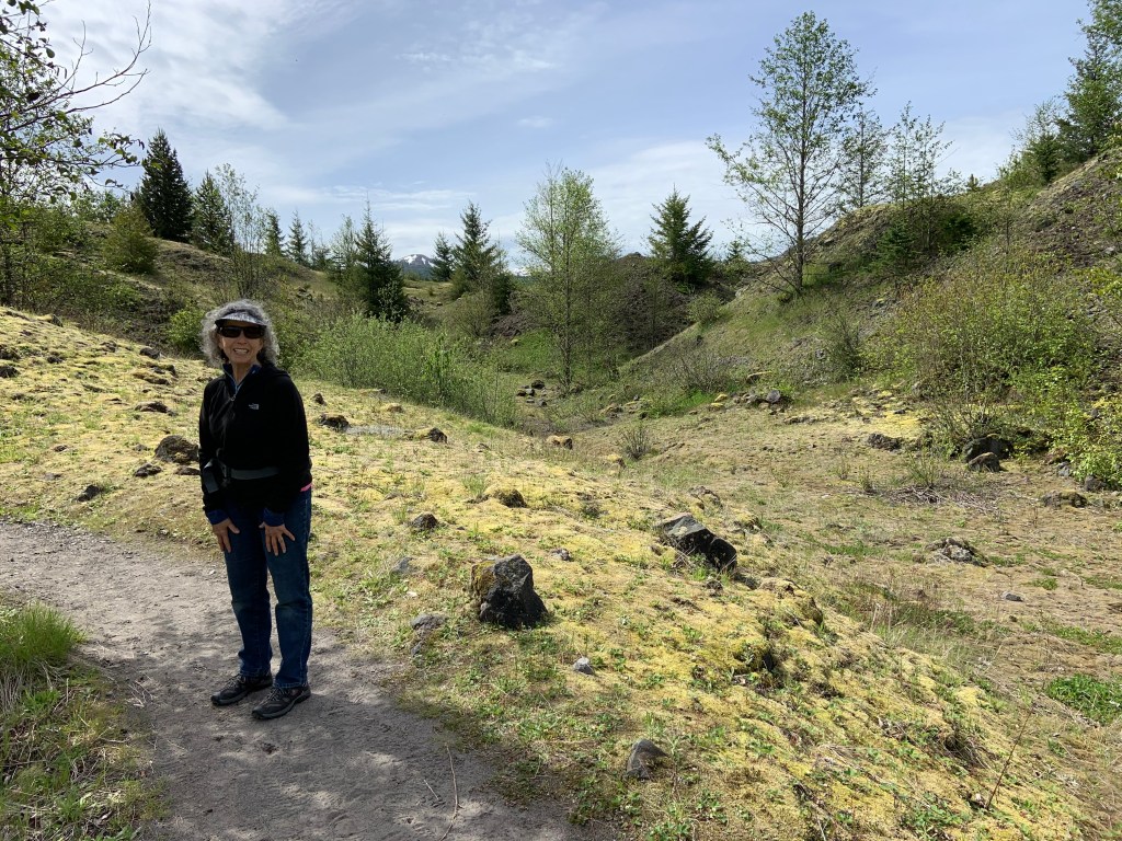
We drove as far as the road would take us, and when we got to the closed gates for Johnson Observatory, we discovered a hike through the debris field called The Hummocks Trail, a 2.5 mile hike into the debris field of the landslides. Scientists discovered something interesting while studying the changing landscape in the wake of the eruption; these “hummock” debris fields are pretty common around explosive volcanoes. They never knew before how common they are, because they never had such a good “before” and “after” picture of a massive volcanic explosion.
The trail leads to many overlook points where a spectacular view can be had of the gaping hole left in the mountain.

We happily trekked onto the trail, through the trees, past the small ponds, until we got to a sign that informed us that, on May 17, 1980, we would have been standing 300 feet in the air at the spot of the sign. Everything around us was new landscape. Called the “hummocks” because it is literally piles of debris that has eroded down somewhat due to nature, and has been covered with the usual blanket: trees, bushes, moss, grass, flowers, all the stuff we usually took for granted on our hike. We saw it all now with a whole new appreciation.
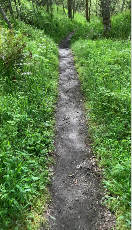
The trail winds over small hills and ravines, with lots of rocks and gravel everywhere. I can only imagine what it would have looked like 40 years ago, with all this stuff either roaring down the canyon at hundreds of miles per hour, or raining from the skies. But we did take it in with great appreciation for the power of nature, and the speed at which Mom Nature operates.
There are many small ponds along the trail, way too numerous to count. Signs informed us that these ponds, and the water that feeds them, are the real culprits for the changing landscape. As rain percolates from above, and the natural snow-melt-fed water table slithers from below, all of these ponds grow and collapse, creating new ravines, and new ponds, and new cliffs, and new micro slides that just keep the whole mess changing until it probably becomes a valley floor once again thousands of years from now. We saw ample evidence of pond breakouts and small slides.
Spirit Lake, at the foot of the mountain, was at first emptied of water, then filled with debris from the blast, mostly trees and rocks. The blast itself pushed the water of the lake into an 800 foot tall “tsunami” that washed up the face of the east cliff, scouring all of the trees and vegetation off of it, which then washed back into the lake. Then ash filled that up. But you can’t stop Mom Nature. Over a comparatively short time, the lake appeared again, and has returned today to become again the headwaters of the Toutle River. And water is a mighty force. The river has, like the Grand Canyon, carved out a channel in all the debris and ash, and flows down the old canyon toward the ocean once again. It’s crazy how fast this stuff happens.
We will go back to see much more, especially when all of the attractions are open again. But you can take this with you for the time being: when you next hike down a trail something like this, appreciate that it could have been here for eons, or just a few decades. You will definitely see your surroundings in a new light!
Tippy always gets the last word.


Excellent descriptions of the area. Fascinating about Mother Nature!